
Walk a Gurnee Street by Address
A useful Gurnee street directory search separates ownership from occupancy. The Lake County property profile identifies the parcel, assessed owner, tax-bill address, legal description, and district fields. A deed names parties to a recorded instrument. Neither source proves who is inside a home today. Dated telephone books, directories, newspapers, and census schedules can add household evidence for older years, while Lake Voter Power is a private, personalized service rather than a public street-wide roll.
- Confirm the street number, direction, suffix, unit, postal city, and ZIP with USPS. Keep any older address form found later.
- Run the normalized line through the Lake County property search. Save the PIN, situs address, mailing field, owner display, and legal description.
- Open Maps Online or the Tax Parcel Viewer. Compare parcels along the street and note subdivision, lot, municipality, and district context.
- Use the PIN, address, and legal description in the Recorder's Official Record Search. Read the document image or request a copy before drawing a conclusion.
- For a dated household question, ask local libraries for the matching telephone, city, or criss-cross volume and verify it against another dated source.
This order keeps one address attached to the same parcel even when names differ. It also makes gaps visible. If the PIN fails in an old deed index, the legal description, subdivision, document number, or handwritten grantor/grantee book may still bridge the record.
Save a source log as the search moves down the block. For each result, note the portal or volume, access date, record date, exact address string, PIN, named field, and whether an image was inspected. Mark an owner, mailing addressee, deed party, directory entry, and applicant as different roles. This prevents names from records created years apart from becoming one assumed household. It also leaves enough detail for a county office or library desk to reproduce the search.
Search Gurnee Parcel Fields
The Lake County property search offers Basic, Advanced, and Map routes. Basic Search accepts a PIN, owner or billing name, street number, direction, street, unit, city, township, or ZIP. It can match exact or partial text and can return active, inactive, or all parcels. Advanced Search adds many property and conveyance criteria, which helps isolate all matching parcels along one Gurnee street.
| Search field | Best street use | Reading caution |
|---|---|---|
| Address No. and Street | Find one parcel or repeat by house number | Direction, suffix, and unit may change the match |
| City Name and ZIP Code | Narrow a broad street-name result | Postal Gurnee does not prove Village jurisdiction |
| Township or Municipality | Separate Warren-area records | Township and village are different units |
| Parcel ID or New PINs | Keep a stable county key | Splits and consolidations can create a new PIN |
| Conveyance Records | Locate dated transfers | A transfer row is not the deed image |
The successful advanced property search capture shows the official filter interface used for this street-by-street work.
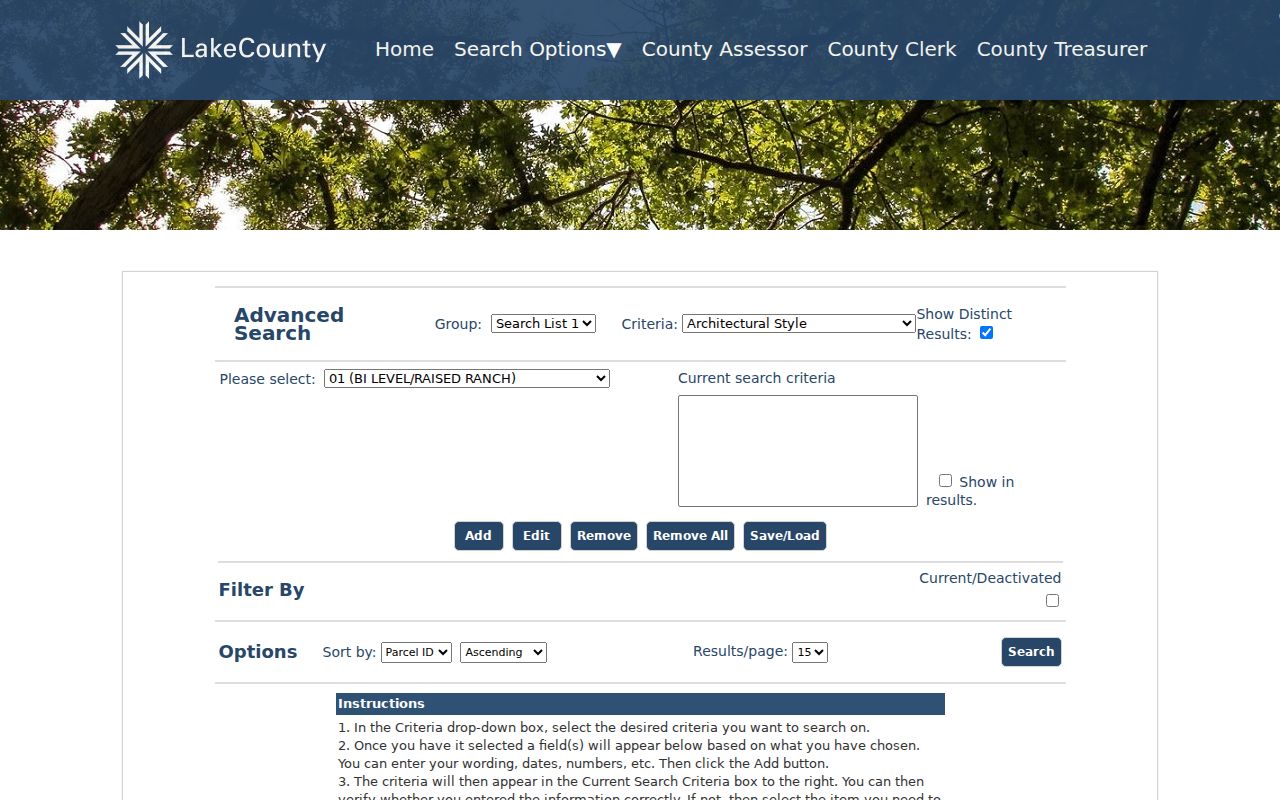
The screen makes clear why a simple address result is only the first pass: parcel, owner, conveyance, municipality, school district, and physical-property fields can all be combined.
Read Gurnee Street Record Labels
Field labels matter. The situs address is the physical location assigned to the parcel. The mailing address is where the tax bill goes, and it may be elsewhere. A parcel is a unit of land used for assessment. Its PIN is Lake County's identifier. A plat is a recorded map of lots, roads, and easements. A criss-cross directory reverses the usual name index by organizing entries by address or telephone number.
- Parcel
- A mapped unit of land assessed under one county record.
- Situs address
- The physical address of that parcel, distinct from the owner's mailing line.
- Plat
- A recorded plan showing a subdivision, lots, streets, and related boundaries.
- Criss-cross directory
- A dated directory arranged by address or telephone number rather than only by surname.
An inspected Gurnee profile shows how rich the record can be: separate owner, general, legal, map, tax, conveyance, exemption, permit, document, photo, and sketch tabs. The official sample parcel profile also distinguishes situs and mailing data.
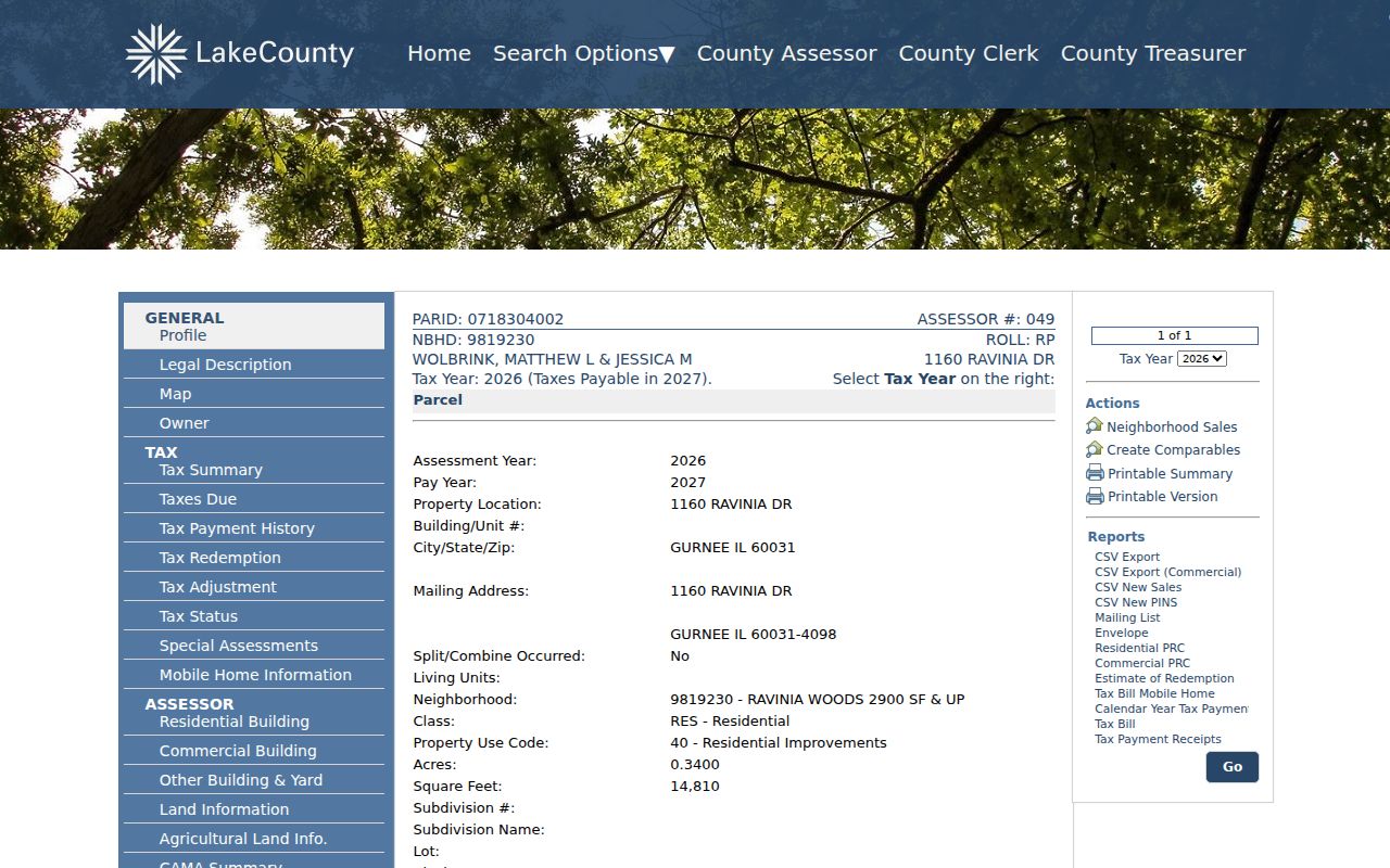
That profile is assessment evidence, not proof of current occupancy or guaranteed title.
Map Gurnee Streets and Parcels
The Lake County GIS Mapping service links Maps Online, the Tax Parcel Viewer, historic parcels, and address or district work. GIS means geographic information system, a map that links shapes to data. Use it to move along a road, identify touching parcels, compare lot shapes, and check district context. County staff also map parcel divisions and consolidations from deeds and plats.
Maps Online was announced as a new implementation in January 2026. The Tax Parcel Viewer also carries a warning against relying on it for a survey or a precise legal boundary. That distinction matters where a road, municipal edge, or subdivision line looks close on screen. The captured GIS guide identifies the official mapping routes and their roles.
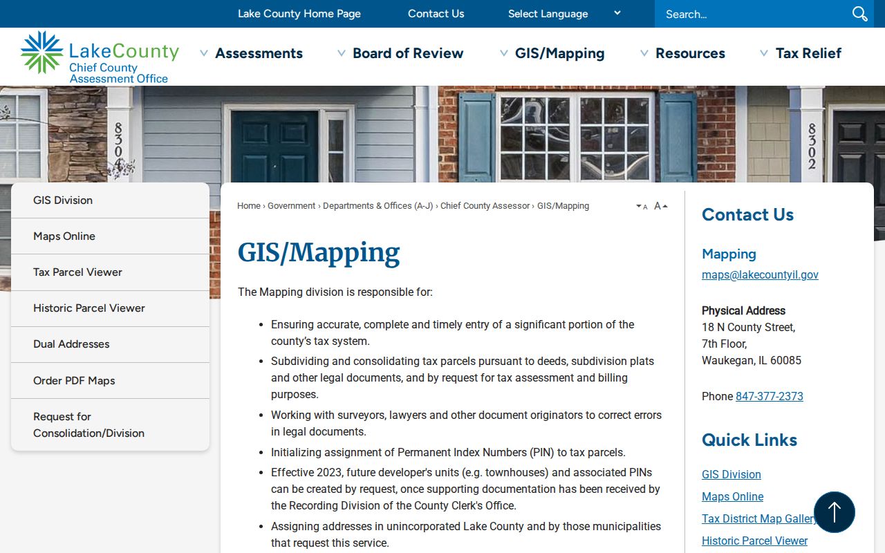
Use the map to locate the parcel, then return to the profile and recorded documents for names and legal text.
Note: A parcel map shows geography and county keys, not a household roster or a survey-grade boundary.
Gurnee Street Records Side by Side
No single Gurnee record answers every address question. The street directory becomes more accurate when each source contributes only the fact it was designed to keep. Online tools are convenient, but the research also documents public terminals, office copy requests, library help, archived books, and written Village requests.
| Address source | Custodian | What it contributes | Access route |
|---|---|---|---|
| Property profile | Lake County CCAO/Treasurer | Owner display, situs, mailing, PIN, legal and tax fields | Basic, Advanced, Map, office |
| Parcel maps | Lake County GIS | Parcel shape, adjacency, districts, historic geometry | Online viewers, GIS office, open data |
| Recorded instruments | Lake County Clerk, Recording Division | Grantor, grantee, document number, legal description | Portal, public terminal, copy request, mail, phone, fax or email |
| Permit and code files | Gurnee Community Development | Address-linked work when supplied by the office | Department contact or Village FOIA |
| Dated directories | WNPL and Waukegan Public Library | Historical address, name, or telephone lead | Catalog, reference desk, microfilm and databases |
The voter layer needs special care. Lake Voter Power gives a registered voter personalized registration, ballot, polling, and district details. Lake County did not expose a public street-wide voter-name search. Do not treat the service as one.
Follow Deeds Along Gurnee Streets
The Lake Official Record Search can take party names, date ranges, document types, PIN, property address, subdivision, legal description, document number, and OCR text. OCR is machine-read text from a scan, so spelling errors remain possible. Search Index Only first, then try full text when a street name does not appear in the structured fields.
Modern Land Records displayed a span beginning January 2, 1980 during research. Historical Record covers handwritten grantor/grantee indexes from 1841 through 1979. A grantor gives or transfers an interest; a grantee receives it. Early documents may not respond to a modern PIN, so use names, legal descriptions, subdivisions, book or file references, and the public terminals at the Recording Division.
The index can lead to deeds, plats, liens, releases, notices, and other recorded instruments. It does not deliver a title opinion. When an image is missing or unclear, request the document from the Lake County Clerk Recording Division at 18 N County Street in Waukegan. Keep the document number and exact index department with the request.
When Gurnee Parcel Keys Change
A street can appear stable while its parcel records change. The official Historic Parcels service has a 1995 through 2024 time extent. Compare its earlier polygon and PIN with the current profile to spot a division, consolidation, or remapped lot. The legal description may preserve continuity when the county key changes.
The historic parcel layer capture shows the county service metadata available for dated map work.
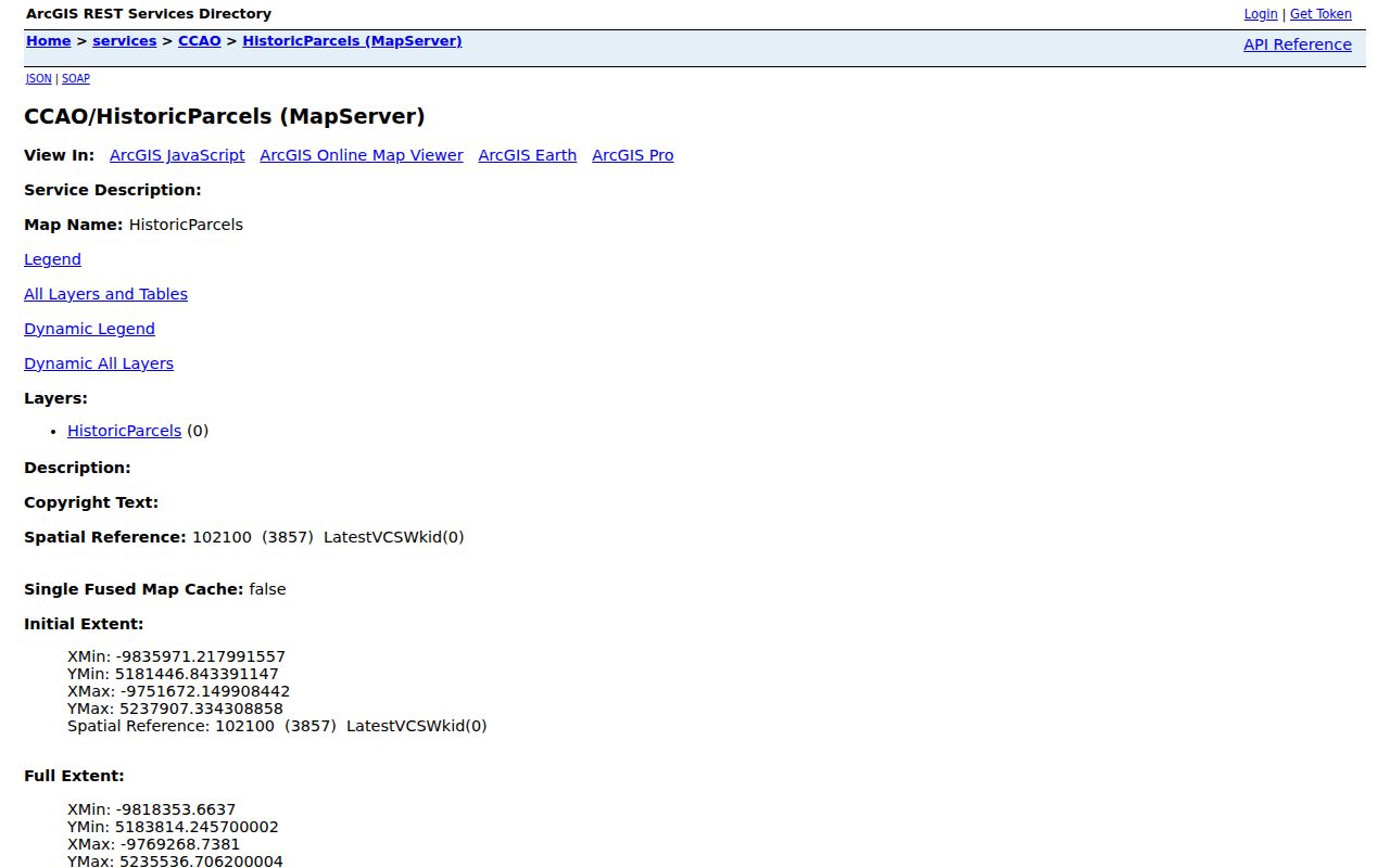
This layer dates parcel geometry, not residents. Match a changed shape back to deeds, plats, and assessment profiles before joining two address records.
Two Address Forms Near Gurnee
Lake County adopted a dual-address ordinance in July 2019 to remove cases where one unincorporated property carried two street addresses. The county estimated about 3,000 affected properties and specifically named Oglesby Avenue and Park Road as Gurnee-area examples. Emergency response, mail, public records, schools, identification, and utilities all benefit from one standard line.
For street directory research, preserve the old address, new address, effective or delivery date, PIN, and issuing authority. The county sends a certified notice, updates county offices, 911, and USPS, while the owner must post and report the new line elsewhere. A blank result under one address may simply mean the record uses the other.
Gurnee's postal city, ZIP, Warren Township, and incorporated Village are also separate concepts. Search the parcel's municipality, tax code, township, and GIS position instead of treating “Gurnee, IL 60031” as proof of one jurisdiction.
Request Gurnee Permit History
The Village's Building Permits page explains permit categories and inspection work, but official pages inspected for this project did not expose a public historical permit or code-case search. That means the fallback comes first: contact Community Development with one address, permit number if known, record type, and date range, or file a focused Gurnee FOIA request.
The captured Village permit page provides the official municipal entry point.

A permit can date work at a property and may name an applicant or contractor. It should not be used to infer every person who occupied the address.
Date a Gurnee Street Directory Entry
Historical address work moves from county portals to library shelves. Waukegan-area Polk and Harris directories have listed runs beginning in 1874, with many later clusters, while telephone books are listed for the 1930s through 1950s. Exact Gurnee coverage varies by title and edition. Ask Warren-Newport or Waukegan Public Library whether a target year has a Gurnee street or reverse section, then record the publisher, year, page, locality heading, exact address, and spelling.
Warren-Newport Public Library also has digitized indexes to Illinois History Collection binders. Waukegan Public Library provides newspapers, microfilm, directories, maps, and an obituary lookup service. The collection details belong on the Gurnee city directories page; for a street search, use only the volume that fits the target date.
Limits of Gurnee Street Records
A Gurnee street directory cannot prove a current household. The assessor identifies an assessed owner and tax-bill address. A deed index identifies parties to an instrument. Old directories reflect one publisher's dated canvass, and voter access is restricted. Motor-vehicle address data is not a public directory, utility customer lists were not found as a public source, and protected or sealed records stay outside ordinary access.
Use address records for property curiosity, genealogy, civic research, or scam checks. Verify any material claim with the custodian and the underlying document. Never convert a historic entry into a present-day statement about a living person.
Lawful use. Gurnee address records are for lawful personal research. Never use a street record to stalk, harass, intimidate, or harm anyone.